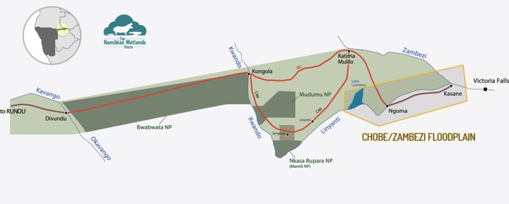
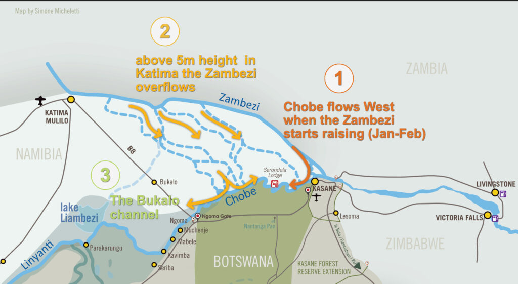
The river begins as a small mountain spring in Angola on the slopes of Mount Tembo, where it is known as the Cuando, only when it enters Namibia is called Kwando. From here, it flows South through the Kalahari sands before it reaches the Linyanti fault (an extensions of the Great Rift Valley) and after forming beautiful swamps it’s named Linyanti. It becomes Chobe only after the area known as Liambezi, where a lake forms in very high flooded season. From here is flows East wards until meeting the mighty Zambezi at Impalila Island.
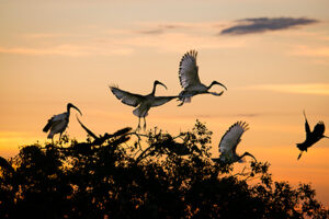
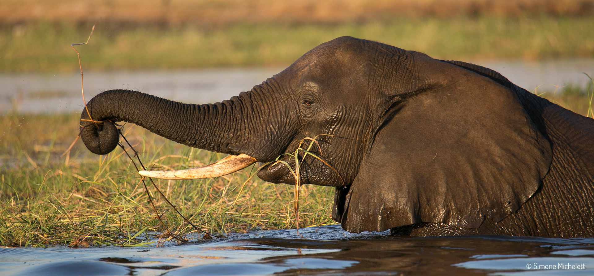
This section of the river attracts an almost unbelievable density of game, including huge herds of elephant (which can often be seen crossing the river) and buffalo, as well as countless hippos and crocodiles. The birdlife is extraordinary too, particularly in the wetter summer months. The wide banks and lush grass attract rare antelope such as red lechwe and puku to the water’s edge. The river is also home to over 90 species of fish.
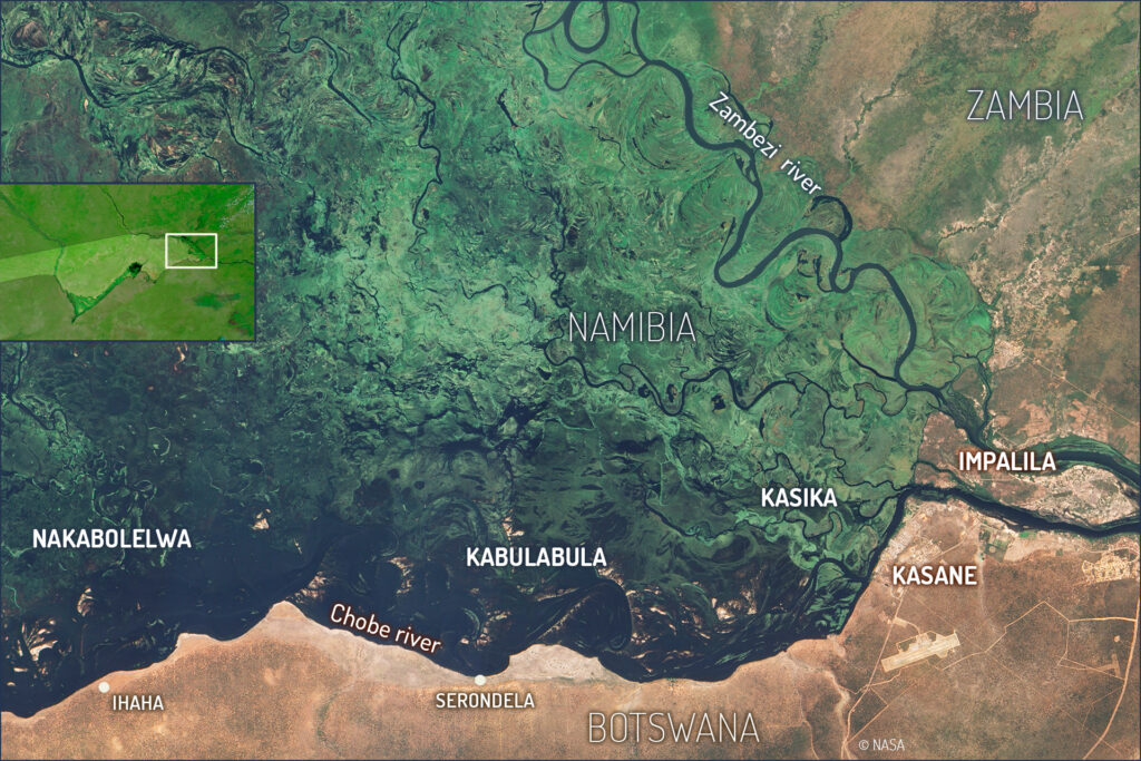
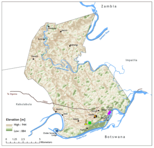
Impalila Island is the ‘far away place’, a small island nestled in the furthest corner of the Zambezi Region in north-eastern Namibia. It is a small conservancy, covering less than a hundred square kilometres, and embraces around 2,000 residents, most of whom speak Subiya, as well as the area’s lingua franca, Lozi. The original inclusion of the finger-like “Caprivi strip” into Namibia was agreed in the late 19th century by European colonial powers at the ‘Berlin Conference’ to allow the German colony access to the Zambezi River. The narrow strip is surrounded by Angola and Zambia to the North, Zimbabwe to east and Botswana to the south. The borders were drawn without following any cultural divisions and separated people with a common heritage into different nations. During the South African administration of Namibia, people were moved off Impalila Island to create a reserve, but a few families returned during the floods of the late 1950s and remained.
The Impalila community began the process to register as a conservancy together with the neighbouring Kasika community, originally intending to register as one conservancy. After a lengthy process, it was decided to form two conservancies, which were registered in December 2005.
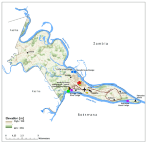
The conservancy itself offers cultural tours that include village visits and cultural performances, as well as fishing trips and dugout canoe rides. The guiding provides great opportunities for visitors to explore the island and make the most of the superb birding and angling. This is an important source of income for the local guides, while the cultural tours also generate income for the villages and craft producers.
Named after the lovers Sala and Bala whose illicit relationship resulted in them being banished to the forest
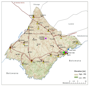
Registered: June 1998
Area: 930 km2
Approximate population: 8,923
Geographical features: Average annual rainfall of 600 mm. Mopane woodland dominates the northern area, while floodplain grasslands cover the southern section.
Particular features:
High diversity of bird species, including many that are rare elsewhere in Namibia; strategic location opposite Botswana’s Chobe National Park.
Major wildlife resources:
Lion, elephant, leopard, buffalo, waterbuck, tsessebe, kudu, duiker, reedbuck, common impala, blue wildebeest, lechwe, hippo, crocodile, plains zebra, warthog, steenbok, interesting bird life, various fish species.
 Quick facts
Registered: October 2014
Area: 207 km2
Approximate population: 2000
 Quick facts
Registered: October 2014
Area: 114 km2
Approximate population: 800
 Quick facts
Registered: November 2011
Area: 89 km2
Approximate population: 500
Quick facts
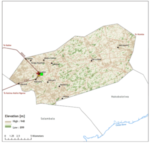
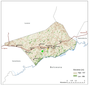
Registered: October 2005
Area: 147 km2
Approximate population: 1100
Geographical features:
Average annual rainfall of over 600 mm. Floodplain area between Chobe and Zambezi Rivers.
Particular features:
Close to Chobe and Zambezi Rivers, with water visible throughout the year. Borders Chobe National Park in Botswana.
Major wildlife resources:
Elephant, buffalo, crocodile, hippo, lechwe, sitatunga, waterbuck, interesting bird life, tiger fish, catfish, various tilapia fish species.
 Quick facts
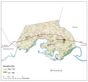
Registered: December 2005
Region: Zambezi
Area: 73 km2
Approximate population: 968
Geographical features:
The island is bounded by the Zambezi and Chobe Rivers. Average annual rainfall is over 600 mm.
Particular features:
Prominent baobab tree from which people can view four countries bordering each other.
Major wildlife resources:
Elephant, buffalo, crocodile, hippo, waterbuck, common impala, lechwe, sitatunga, warthog,bbushbuck, interesting bird life, tiger fish, catfish, various tilapia fish species.
