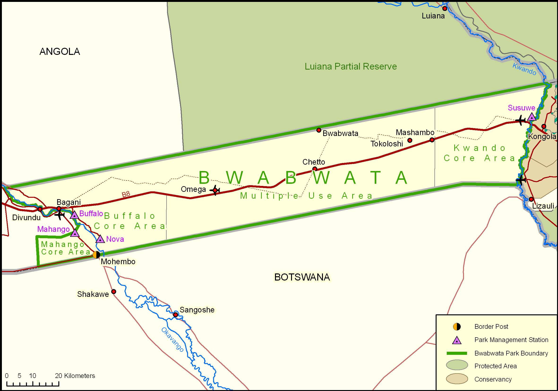
 The park was first proclaimed as the Caprivi Game Reserve in 1966 and upgraded to the Caprivi Game Park in 1968. It was gazetted as the Bwabwata National Park in 2007 and incorporated the former Mahango Game Reserve. The park has had a chequered history as it was declared a military area by the South African Defence Force during Namibia’s war of liberation. It was not until after Independence in 1990 that the park could be properly run as a conservation area. A survey was conducted in the park at Independence to investigate the status of the fauna and flora after the military occupation and to assess the circumstances of the 5 000 people living in it. This survey laid the foundation for the current management approach in the park, which incorporates the needs of the people living there. The survey also laid the foundation for the zoning of the park, which has a core conservation area in the west along the Okavango River, a multiple use area in the central part of the park and a core conservation area in the east along the Kwando River. Development of infrastructure, provision of equipment and park planning are being supported by the German Government through KFW and implemented by Namibia Parks Programme (NAMPARKS).
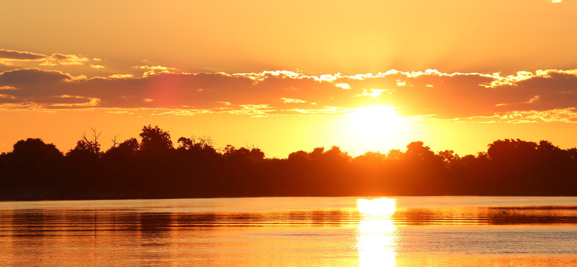
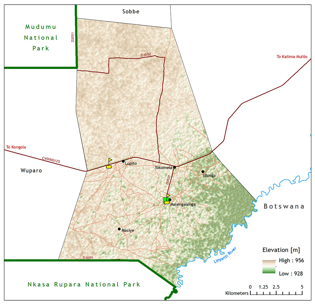
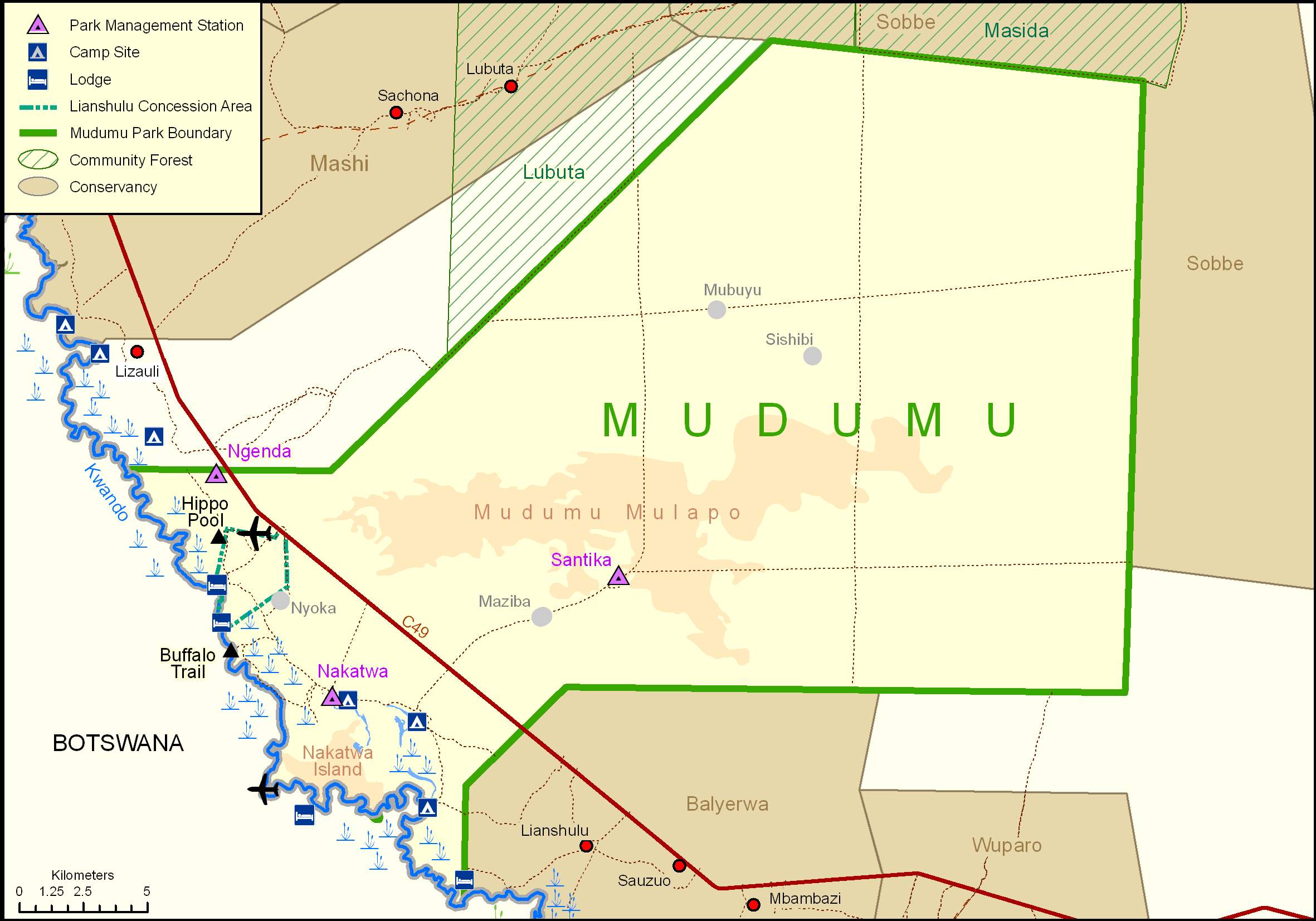 Mudumu National Park, one of Namibia’s least-known parks, is richly rewarding for adventurous visitors. The main attraction is the riverine habitat of the Kwando River, while inland is the Mudumu Mulapo fossilised river course and the dense mopane woodland shelter woodland species. There is no formal entrance gate or park fence – the park is separated from neighbouring communal farmland by a graded cutline. Mudumu is home to a large elephant population. The park acts as a corridor for these pachyderms as they migrate between Botswana, Zambia, Angola and Zimbabwe. In recent years, Mudumu has become the model for co- operation between parks and neighbours. The parks, conservancies, community forests and traditional leaders work together on law enforcement, fire management (early burning), game monitoring and translocations. This evolved from the need to manage common resources across unfenced park and conservancy boundaries.
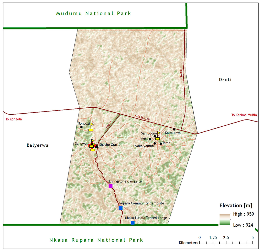
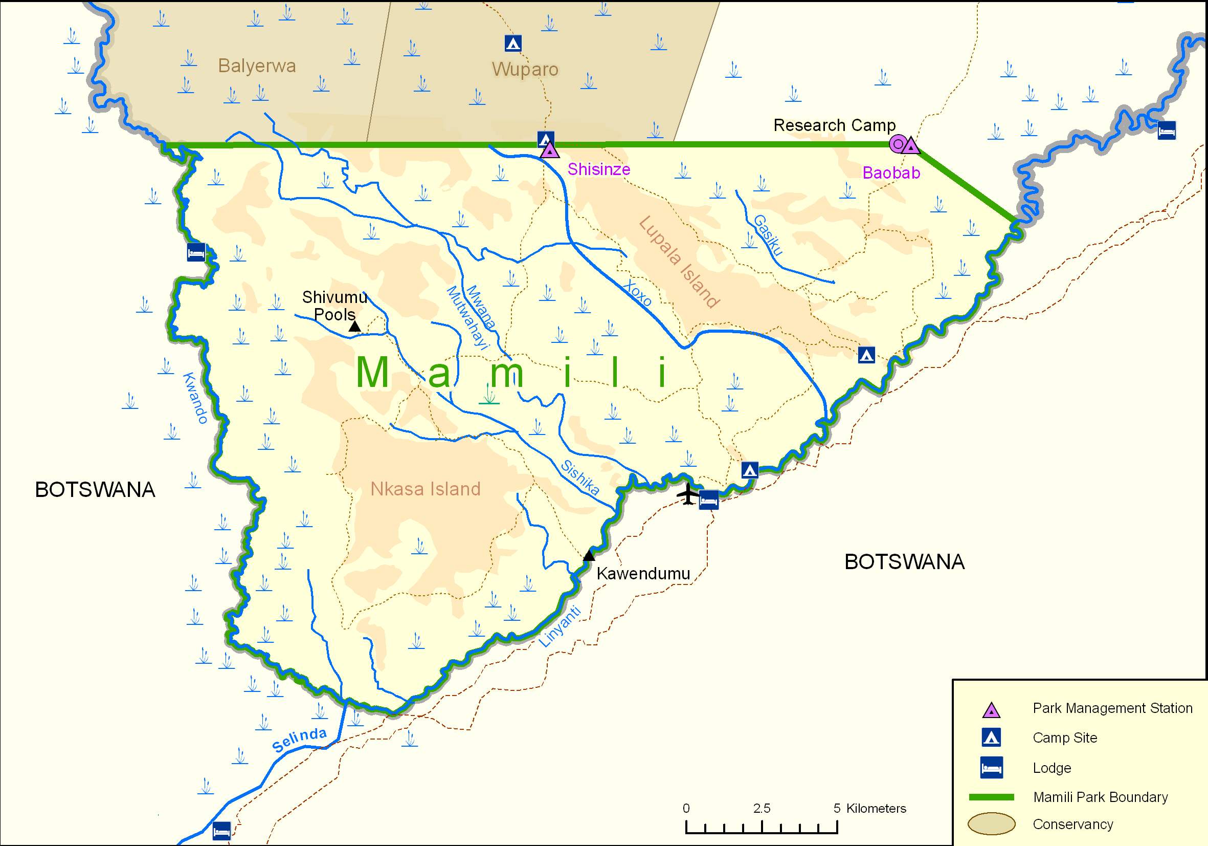 Nkasa Rupara National Park formally known as Mamili National Park was officially proclaimed on 1 March 1990, just days before Namibia gained Independence. This is the largest wetland area with conservation status in Namibia, and is a haven for wetland species. When the flood waters from the Kwando River are high, the park becomes like a mini Okavango Delta. There are about 1 000 buffaloes in Nkasa Rupara, the largest concentration in the country. It is an important corridor for elephants moving from Botswana to Angola and Zambia and is also considered as a core breeding area for wildlife that can disperse into neighbouring conservancies. There are Conservancies in this areas
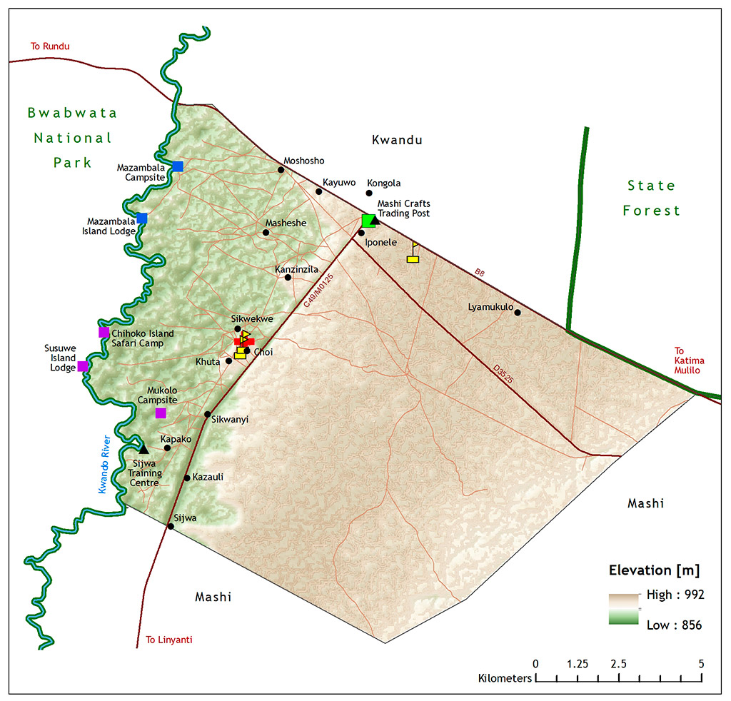
The Mayuni Conservancy was established with support from Chief Mayuni, who has been a
strong driving force for conservation in the area.
Quick facts
Registered: December 1999
Area: 151 km2
Approximate population: 2,598
Geographical features:
Average annual rainfall of about 600 millimetres. The Kwando River floodplain is dominated by
grasslands and swamp vegetation, while much of the woodland on higher ground to the east has
been cleared or damaged by frequent fires.
 Derived from the name of a tree that produces fruits; also an alternative name for the Kwando
River)
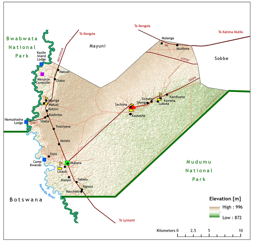
Quick facts
Registered: March 2003
Area: 297 km2
Approximate population: 2,431
Geographical features:
Kwando River and its floodplains, with Kalahari woodlands to the east. Rainfall averages 600 mm
per year.
 Derived from the Yeyi name for a now dry swamp that provided residents with a variety of natural
resources.
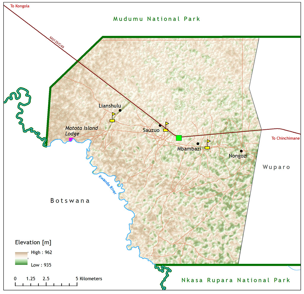
Quick facts
Registered: October 2006
Area: 223 km2
Approximate population: 1,307
Geographical features: A mosaic of woodland and grassland. The average annual rainfall is 600
mm.
 Wuparo means “life” in Siyeyi. The Conservancy was started by the Mayeyi Traditional Authority in
1997 after they found that the community was not reaping the benefits of the natural resources.
Registered: December 1999
Area: 148 km2
Approximate population: 1,027
Geographical features:
This area is very variable, depending on the annual rain fall it transforms itself from a floodplain to
a mosaic of woodland and grassland. Average annual rainfall of 600 mm.
 Named after the Dzoti River Channel
Quick facts
Registered: October 2009
Area: 287 km2
Approximate population: 2,029
Geographical features:
Linyanti River with associated flood plain areas. Broad-leafed tree and shrub savannah away from
the river. 550-600mm average annual rainfall.